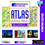
This definitive reference atlas presents Great Britain through high quality interactive maps. The whole country is covered at 1:250 000 scale. Selected places and areas of interest are covered with larger scale maps for more detailed investigation.
- Ordnance Survey Maps - Eight levels of zoom into Ordnance Survey maps of Britain at 1:625 000 and 1:250 000 scales. Further map extracts at 1:50 000, 1:25 000 and 1:10 000. Gazetteer gives instant access to 45,000 locations.
- European Data - Hundreds of EU facts and figures presented as easy-to-use comparative graphs and charts; including ethnic groups, trade statistics, and energy production and consumption.
- Town & City Centre Plans - 45 street plans from the Ordnance Survey, including London, Edinburgh, Cardiff, Birmingham, Liverpool, Glasgow, Bristol, Reading and York.
- GB Data - British statistics brought to life in full-colour maps; Politics, People, Climate and Physical Features.
- Map Skills - Detailed, step-by-step illustrated instructions and activities teach you how to interpret maps.
- Interactive Features - Customise the maps, to focus attention on particular features. Measure the straight-line distance between any two points. Print the maps and plans in full colour. Over 350 places of interest illustrated in text, photographs, video, and landscape models.
- Around Britain Quiz - A race around Britain against the clock, with questions on places, people, events and legends.
Windows 3.1x, Windows 95 or Windows 98, 486DX-2 66Mhz processor or faster (Pentium recommended), 8MB free hard disk space, 16MB RAM, 16bit SoundBlaster or 100% compatible soundcard & dual speed CD-ROM drive.

Price: £8.50 (+VAT)
Format: PC CDROM
Product Code: ESS166